1、前言
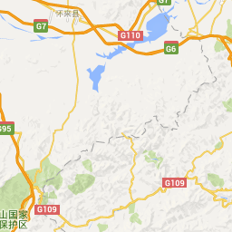
http://mt2.google.cn/vt/lyrs=m@225000000&hl=zh-CN&gl=cn&x=420&y=193&z=9&s=Galil
通过图层扩展类的方式加载Google地图的是我们通常获取Google地图的一种方式,根据这种方式我们可以通过拼接地图瓦片Url字符串获取瓦片数据,关于Google瓦片算法的解析网上有很多,以下仅列出博客地址,及具体实现类。
Google瓦片地图算法解析 :http://blog.csdn.net/hugoandpig/article/details/7719307
转载请注明出处:http://www.cnblogs.com/gis-luq/p/5443498.html
2、Google地图的自定义扩展类
package com.seraph.collect.BaseComp.MapLayer;import java.util.Map;
import java.util.concurrent.RejectedExecutionException;import android.util.Log;import com.esri.android.map.TiledServiceLayer;
import com.esri.core.geometry.Envelope;
import com.esri.core.geometry.Point;
import com.esri.core.geometry.SpatialReference;/***Google地图加载*/
public class GoogleMapLayer extends TiledServiceLayer {private int minLevel = 0;private int maxLevel = 19;private String[] subDomains = new String[] { "mt1", "mt2", "mt3" };private double[] scales = new double[] { 591657527.591555,295828763.79577702, 147914381.89788899, 73957190.948944002,36978595.474472001, 18489297.737236001, 9244648.8686180003,4622324.4343090001, 2311162.217155, 1155581.108577, 577790.554289,288895.277144, 144447.638572, 72223.819286, 36111.909643,18055.954822, 9027.9774109999998, 4513.9887049999998, 2256.994353,1128.4971760000001 };private double[] resolutions = new double[] { 156543.03392800014,78271.516963999937, 39135.758482000092, 19567.879240999919,9783.9396204999593, 4891.9698102499797, 2445.9849051249898,1222.9924525624949, 611.49622628138, 305.748113140558,152.874056570411, 76.4370282850732, 38.2185141425366,19.1092570712683, 9.55462853563415, 4.7773142679493699,2.3886571339746849, 1.1943285668550503, 0.59716428355981721,0.29858214164761665 };private Point origin = new Point(-20037508.342787, 20037508.342787);private int dpi = 96;private int tileWidth = 256;private int tileHeight = 256;public GoogleMapLayer() {super(true);this.init();}private void init() {try {getServiceExecutor().submit(new Runnable() {public void run() {GoogleMapLayer.this.initLayer();}});} catch (RejectedExecutionException rejectedexecutionexception) {Log.e("Google Map Layer", "initialization of the layer failed.",rejectedexecutionexception);}}protected byte[] getTile(int level, int col, int row) throws Exception {if (level > maxLevel || level < minLevel)return new byte[0];String subDomain = subDomains[(level + col + row) % subDomains.length];
     //构建待拼接字符串
     String _mapType = "m@225000000";String url = "http://" + subDomain+ ".google.cn/vt/lyrs=" + _mapType + "&hl=zh-CN&gl=CN&src=app&" + "x=" + col + "&" + "y=" + row + "&" + "z=" + level + "&s=Ga";Map<String, String> map = null;return com.esri.core.internal.io.handler.a.a(url, map);}protected void initLayer() {if (getID() == 0L) {nativeHandle = create();changeStatus(com.esri.android.map.event.OnStatusChangedListener.STATUS.fromInt(-1000));} else {this.setDefaultSpatialReference(SpatialReference.create(102113));this.setFullExtent(new Envelope(-22041257.773878,-32673939.6727517, 22041257.773878, 20851350.0432886));this.setTileInfo(new TileInfo(origin, scales, resolutions,scales.length, dpi, tileWidth, tileHeight));super.initLayer();}}}